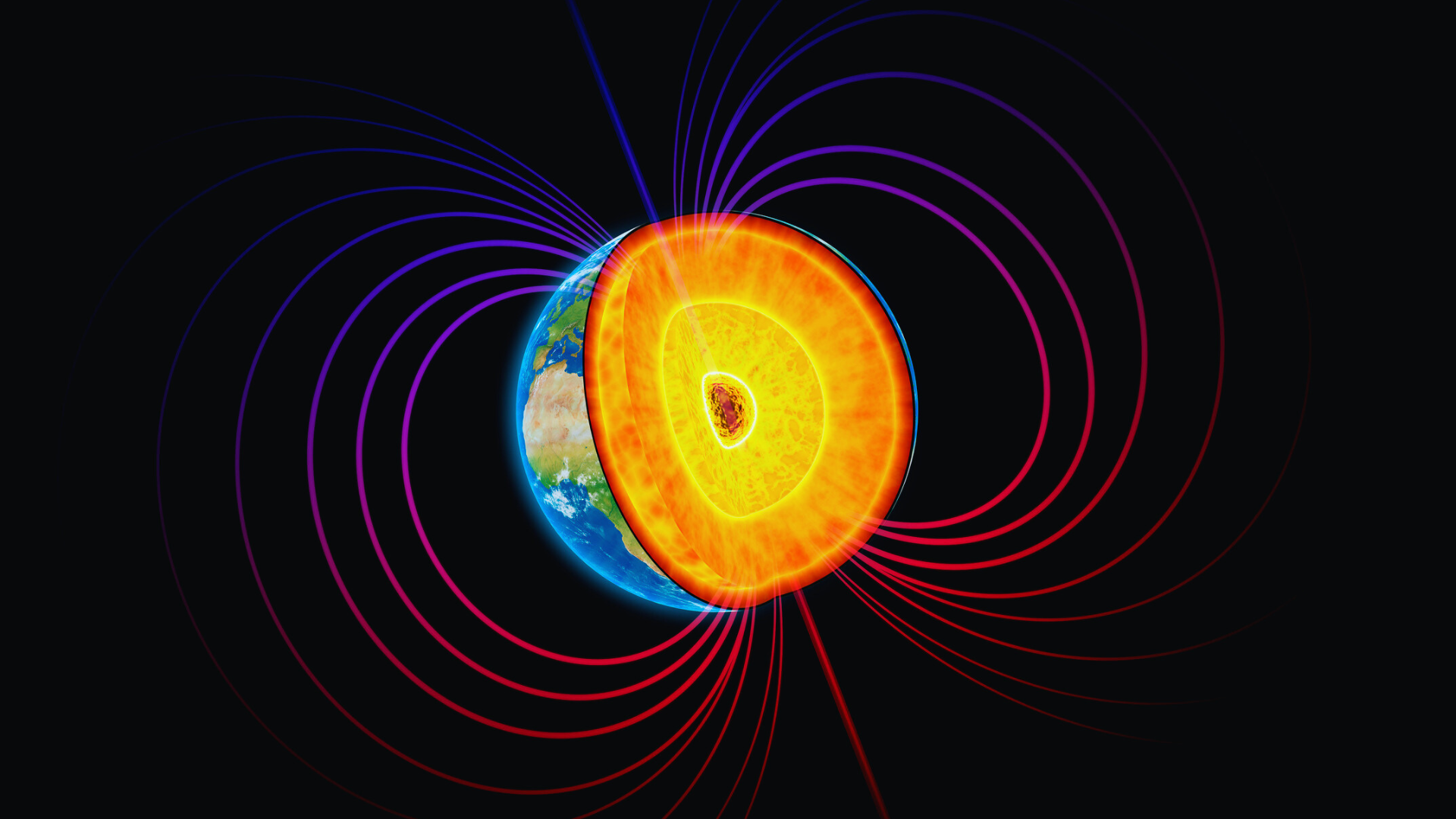
Earth’s magnetic field plays a crucial role in navigation by providing a natural reference point for direction. Magnetic compasses rely on Earth’s magnetic field to point north, enabling travelers, sailors, and explorers to orient themselves even without modern technology. The connection between Earth’s magnetic field and navigation lies in how the magnetic field guides compasses, making it possible to determine direction accurately across the globe.
This invisible force extends from Earth’s core into space and varies slightly depending on location, influencing navigation methods. It has been essential for centuries and remains relevant today, especially in remote areas where GPS signals may not reach. Understanding this relationship helps explain why magnetic compasses work and why navigational methods have evolved around Earth’s magnetic properties.
Earth’s Magnetic Field: Generation and Structure
Earth’s magnetic field originates from dynamic processes deep within the planet and extends outward into space, affecting navigation and protecting the planet from solar radiation. Its structure includes several key components that define how it operates and varies over time.
The Earth’s Core and the Geodynamo
The magnetic field is generated by the geodynamo effect in Earth’s outer core, where molten iron moves due to convection currents. These movements create electric currents, which in turn generate magnetic fields through electromagnetic induction.
The outer core surrounds the solid inner core and consists mainly of liquid iron and nickel. Heat from the inner core causes convection in the outer core, driving continuous motion. This motion sustains the planet’s magnetic field without external energy input.
The process is similar to an electric generator, with the flow of conducting liquid iron acting as the moving conductor. This geodynamo explains why Earth’s magnetic field is strong, stable, but also slowly changes in intensity and direction.
Magnetosphere and Its Role
The magnetosphere is the region around Earth dominated by its magnetic field. It deflects solar wind, the charged particles from the Sun, protecting the atmosphere and surface.
Its shape resembles a teardrop, compressed on the side facing the Sun and stretched on the night side. Magnetic field lines extend from the magnetic north pole to the magnetic south pole, creating a protective shield.
Without the magnetosphere, solar wind would strip away atmospheric particles, posing risks to life and disrupting communication systems and navigation technology. Its interaction with solar radiation also causes phenomena like the auroras near the poles.
Magnetic Poles and Their Movement
Earth’s magnetic north and south poles are points where magnetic field lines are vertical. These poles differ from the geographic poles, which are fixed locations defined by Earth’s rotation axis.
The magnetic poles move over time due to changes in the outer core’s flow patterns. This movement can span tens of kilometers per year. Tracking these shifts is vital for accurate compass navigation and updating navigational maps.
Magnetic pole reversals have occurred hundreds of thousands of times in Earth’s history, where the north and south poles swap. These reversals take thousands of years and happen irregularly, but influence magnetic field strength during transitions.
The Magnetic Field and Navigation Principles
Earth’s magnetic field influences how navigational instruments behave, especially compasses. Understanding the relationship between magnetic forces and navigation helps clarify how direction is determined and adjusted.
How Compasses Work
A magnetic compass contains a compass needle that aligns itself with Earth’s magnetic field. The needle is magnetized so its north end points toward the magnetic north, near Earth’s North Pole. This allows the compass to indicate direction relative to magnetic north.
The compass needle pivots freely on a low-friction point. When it settles, the needle aligns with the horizontal component of Earth’s magnetic field. Navigators use this alignment to find bearings and maintain a course.
Magnetic North vs. Geographic North
Magnetic north is the point on Earth where the planet’s magnetic field lines are vertical and point downward. It differs from the geographic north, which is the fixed point marking Earth’s rotational axis at the North Pole.
Magnetic north moves due to changes in Earth’s core and magnetic field. In contrast, geographic north remains constant. This discrepancy creates differences navigators must account for when using a compass.
Understanding Magnetic Declination
Magnetic declination is the angle between geographic north and magnetic north from an observer’s standpoint. It varies depending on location and changes over time.
Declination can be measured in degrees east or west. Positive declination means magnetic north is east of geographic north; negative means west. Navigators adjust their compass readings by adding or subtracting the declination to find true north.
Magnetic Inclination and Navigation
Magnetic inclination, or dip, is the angle at which Earth’s magnetic field lines enter or exit the surface. Near the magnetic poles, the field lines are steeply inclined; near the equator, they are nearly horizontal.
Inclination affects the compass needle’s vertical balance. In high latitudes, the needle may tilt or bind, reducing accuracy. Special compasses with balanced needles are used in polar regions to compensate for this effect.
Applications and Challenges in Modern Navigation
Earth’s magnetic field plays a central role in different navigation contexts, with its variations and measurements directly influencing technology performance. The interplay between magnetic data and satellite systems shapes the accuracy and reliability of navigation in complex environments.
Maritime and Aviation Uses
Magnetic compasses remain fundamental in maritime navigation, serving as reliable backup tools during GPS failures or signal disruptions. Mariners depend on local magnetic field strength and declination data to correct compass readings and maintain accurate courses, especially in high-latitude regions where magnetic variations are pronounced.
Aviation similarly relies on magnetic headings for aircraft orientation during flight. Pilots use magnetic bearings in conjunction with inertial systems, particularly when flying near polar regions where magnetic anomalies and space weather can affect navigation instruments. Magnetic interference in these zones poses challenges to traditional compass-based systems.
Role of Magnetometers and IGRF
Magnetometers measure Earth’s magnetic field strength and direction, offering critical data for navigation systems to adjust for local variations. These instruments are integrated into many modern platforms, including ships and aircraft, to support real-time corrections and enhance situational awareness.
The International Geomagnetic Reference Field (IGRF) models Earth’s magnetic field globally, providing standardized data used in navigation software. Updating the IGRF every five years ensures that evolving magnetic field variations, due to geomagnetic secular changes, are incorporated into navigation computations, improving accuracy worldwide.
Magnetic Field Variations and Satellite Systems
Magnetic field variations caused by solar wind and space weather events can disrupt satellite-based navigation systems such as GPS. These disturbances impact satellite operations and signal integrity, leading to potential localization errors.
Satellites rely on magnetometers to detect and compensate for these magnetic fluctuations. However, polar regions experience intensified magnetic storms, complicating navigation and satellite communication. Understanding how magnetic strength fluctuates allows operators to mitigate risks and maintain reliable navigation globally.